
Published in Midwest Flyer – December 2019/January 2020
 Incorporating the latest technology in developing an airport layout plan can provide crucial information to decision-makers in a visual and interactive manner. The aviation services group at Bolton & Menk uses innovative tools to think outside the box during the airport planning process and beyond. They create successful outcomes for airports by integrating unmanned aircraft systems (UAS) and geographic information systems (GIS) technology into their airport projects.
UAS IMPLEMENTATION
Bolton & Menk’s innovation in airport planning is based on using small UAS aircraft to capture high-quality aerial imagery during planning, design and construction. This imagery can be used to provide base maps for airport layout plans (ALP) and interactive GIS interfaces, completing airspace reviews, estimating pavement maintenance projects, and providing post-construction airport imagery. Using a fleet of UAS aircraft, Bolton & Menk’s licensed UAS pilots can fly over an airport and surrounding property to capture imagery within a few hours. Once processed, planning and engineering staff will review gathered imagery to evaluate existing airport conditions and develop alternatives to assess potential impacts in an interactive, three-dimensional GIS environment.
GIS INTEGRATION
Using GIS software, the staff at Bolton & Menk provides airport sponsors (i.e. municipalities) an interactive experience by integrating various databases, such as property parcels, pavement conditions, land-use zoning, and obstructions into a single interface. This interface allows users to see information in a detailed three-dimensional view. It allows the staff to compare airport alternatives and visualize safety critical surfaces and setbacks.
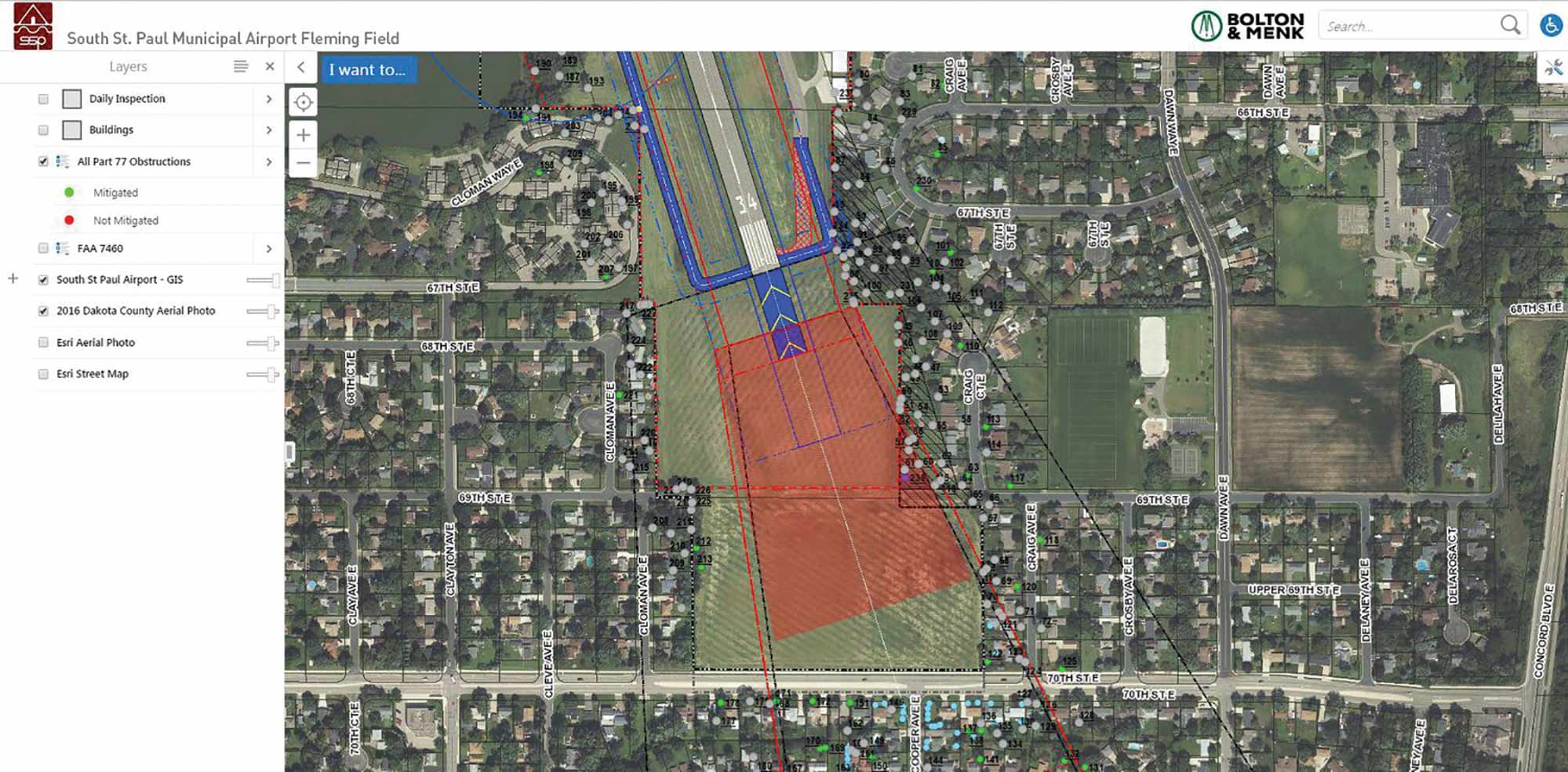
Decision-makers will have a better understanding of the relationship between physical attributes on the ground, safety critical areas, and three-dimensional airspace. GIS software also allows airport sponsors to use UAS imagery to assess airport infrastructure in a more current environment than previously possible.
If UAS imagery is gathered on a yearly or event-driven basis, sponsors can monitor airport conditions, assess maintenance projects and identify potential airport problems. The ability to integrate GIS into the decision-making process ultimately leads sponsors to make well-informed decisions on managing airport operations, as well as ensuring success for the airports future.
For more information on how Bolton & Menks innovative technology can help your airport planning process, contact Jared Wingo at Jared.Wingo@bolton-menk.com.