Full-Depth Pavement Reclamation At Airports….

More Economical, Environmentally Friendlier & Faster Than Total Pavement Reconstruction Methods

Published in Midwest Flyer Magazine December 2022/January 2023 Digital Issue

When full-depth pavement “reconstruction” isn’t financially feasible, and a mill and overlay will only provide a short-term solution, airports often find themselves in a bind.

To minimize disruption of airport operations and keep cost down, Bolton & Menk, an engineering firm with offices in Mankato, Minnesota, and elsewhere in Minnesota, North Dakota, Iowa, North Carolina, and South Carolina, applies the full depth “reclamation” (FDR) process to reconstruct the pavement at airports. FDR is the process of pulverizing the existing thickness of asphalt surfaces and blending it with the underlying aggregate base layer to form a reclaimed asphalt base layer. This layer is then shaped, graded, and compacted with a new asphalt surface paved over it. Bolton & Menk uses the FDR process to recycle existing materials to provide a high-quality product at substantially lower cost than complete reconstruction methods.

The FDR Process

Step 1: Evaluate the Pavement
• Evaluate the existing asphalt and aggregate based thickness to determine if
FDR is the best approach.
Step 2: Reclaim the Existing Pavement
• Pulverize the existing asphalt layer and blend it with the underlying
aggregate base layer to create a reclaimed asphalt base layer.
Step 3: Grade, Shape, and Compact The Reclaimed Base Layer
Step 4: Pave New Asphalt Surface Over Reclaimed Base

Why FDR?

Bolton & Menk uses the FDR process to recycle existing materials to provide a high-quality product at a substantially lower cost. The company first worked with the Federal Aviation Administration (FAA) in 2015 to allow utilizing the FDR process on airports before it became officially allowed.
• Using the FDR process reconstructs pavement with a substantially lower construction time and cost, resulting in little downtime for the airport.
• Pavements reconstructed utilizing the FDR process are environmentally friendly by greatly reducing emissions from dump trucks.
• Pavements reconstructed utilizing the FDR process have shown to perform as well as full-depth reconstructed pavements over their 20-year design life.

The History of the FDR Process

• 2015 – FAA allowed the City of Hutchinson, Minnesota to reconstruct Runway 15/33 utilizing the FDR process.
• 2016 – FAA allowed the City of Litchfield, Minnesota to reconstruct Runway 13/31 utilizing the FDR process.
• 2017 – FAA allowed the City of Willmar, Minnesota to reconstruct taxi lanes utilizing the FDR process.
• 2018 – FAA created its own specification for full-depth reclamation.
For more information about the FDR process, contact Silas Palmer at Silas.Palmer@bolton-menk.com (www.bolton-menk.com).

Posted in Airports, All Headlines, February/March 2023, Headlines, Headlines, Products & Services | Tagged , , , , , | Leave a comment

Air Service From Your Regional Airport

by Kevin Carlson
Planning Program Coordinator – North Region
Minnesota Department of Transportation – Aviation

Published in Midwest Flyer Magazine December 2022/January 2023 Digital Issue

The airline industry is in a period of rapid change. The major airlines had faced fierce competition from low fare carriers in many large markets and then the COVID pandemic hit and basically shut down the entire airline industry. The large airlines had been relying on smaller regional airlines to serve the smaller markets. The regional carriers are still converting their fleets from turboprops and small 50-seat regional jets to larger 90 to 150 seats and less frequency. This trend could result in the loss of air service in some of the small, less populous markets. Currently, there are nine airports in Minnesota with commercial service: Minneapolis-St. Paul-(HUB), Duluth, Rochester, St. Cloud, Bemidji, Brainerd, Chisholm-Hibbing, International Falls, and Thief River Falls.

The Local Airline Service Action Committee (LASAC) was organized in 1964. The purpose of this small but influential organization is to promote airline service to small and medium size communities in Minnesota. This group has provided congressional testimony for the continuation of the Essential Air Service Program, encouraged marketing plans for member airports, provided united support in negotiations with airlines to retain flight schedules and services in the remote areas of our state, and represented important business needs of those communities to national leaders.

Having a hub airline at MSP contributes to both the quantity and quality of air service in Minnesota. Without it there would be fewer flights overall and fewer destinations with nonstop service.

Worthington, Mankato, Fergus Falls and Fairmont lost commercial air service to their community in the 1990s. Grand Rapids lost commercial air service in 2003.

Understanding Your Airports Air Service Needs

One of the most important factors in evaluating the ability of a community to support expanded air service is to understand how people in a region use the air service that’s available. No airport retains all the passengers that travel to and from its core market area. The single most important piece of data an airport can understand is what share of passengers traveling to and from the immediate region use its services and what share drive to competing airports. Drive diversion or passenger “leakage” studies, statistically analyze passenger data, determining just how many core market passengers use their local airport, and how many drive to other airports. The overall market size is critical in making the case that a region can support more service. This type of data can figure out why passengers drive to other airports. It could be lower fares or non-stop flight options.

Understanding your local Airports Air Service needs is critical. Air services drives airport revenue sources and stimulates regional economic development growth including visitor expenditures and tax revenues. By providing new travel choices, increased competition, greater convenience and possibly lower fares, new travel and economic opportunities are generated for local businesses, residents, and visitors. While air carriers are continually looking for new routes to serve, they do not always have the resources and local data to examine all potential routes. Airports play a critical role in bringing new route opportunities to the attention of carriers. In addition, the air service development strategy forms the basis for coordinating stakeholder support and ensuring that efforts and resources are focused on those opportunities with the greatest potential for success. Air service development is therefore a vital activity which should be at the center of the strategic planning process for every airport.

Air Service Marketing Program MnDOT Aeronautics

Air Service Marketing legislation enacted in 1997 (State Statute 360.0151) provides assistance to those communities in obtaining or enhancing scheduled air service. Funding for this program comes out of the State Airport Fund. The fund started at $150,000.

Eight Greater Minnesota communities with commercial air service are eligible to apply for a reimbursable Air Service Marketing Grant which has an appropriation of up to $300,000 biennially. Eligible expenses for reimbursement are advertising of air service, public relations activities intended to educate the public on the value of the airport and its commercial passenger air service, marketing studies, and service improvement activities such as route analysis.

The marketing program may also be used to fund studies to determine the feasibility of commercial air service.

Grants may not be used for an activity that promotes an airport within the service area of another airport, a promotional activity that features one specific air carrier at an airport when more than one air carrier serves the airport, administrative costs associated with the marketing program or with the routine operation of the airport, or payments to air carriers as fare subsidies, service subsidies, or seat guarantees.

Continuing Support

The Office of Aeronautics continues to work with airport sponsors (i.e., the municipality, county, airport authority that owns the airport) to provide technical and financial assistance for this Air Service Marketing Program.
For more information contact: Rylan Juran, Planning Director, Rylan.Juran@state.mn.us

Posted in Columns, Columns, Columns, February/March 2023, MN Aeronautics Bulletin | Tagged , , , , , , , , , , , , | Leave a comment

A College Degree Is No Longer Required For Many Top-Paying Jobs In Aviation

by Dave Weiman
Published in Midwest Flyer Magazine December 2022/January 2023 Digital Issue

Let me preface this editorial by stating that I believe in higher education, but I question when students go into debt to pay for ridiculously high college tuitions, sometimes wasting both time and money on worthless degrees where there are no jobs! Also, not everyone knows what they want to do immediately after graduating from high school and need time to explore different career options.

And what about professions that require college degrees when they are not necessary? Airline pilots used to be in that category, but due to pilot shortages, a degree is no longer required by many airlines. The airlines – and the FAA – are more interested in a pilot’s flight-time and ratings, as they should be.

That said, I am pleased that the demand for employees in most fields in aviation is strong, and that there are exciting opportunities to earn while a person learns.

Our industry’s first job is to attract people to our industry, and that’s where our state aeronautics offices are doing a great job through Aviation Career Education (ACE) camps and programs. Through ACE, young people can explore different careers, participate in internships, and receive the mentorship they need to succeed.

Matthew Armstrong of Delta Air Lines, said this about the ACE program:

“We’re proud to be part of this development opportunity. The industry exposure for the students is invaluable and our employees love being mentors to them. It also gives us a longer look at potential future employees. We have several (students) from last year that we are waiting to turn 18, so we can hire them.”

Signature Flight Support, the Transportation Security Administration (TSA), American Airlines, and other employers provide similar feedback.

If you are an aviation-related business in Wisconsin and would like to get involved in the ACE program, contact Meredith Alt at the Wisconsin Bureau of Aeronautics: meredithl.alt@dot.wi.gov, 608-266-8166. In Minnesota, contact Darlene Dahlseide with the Minnesota Office of Aeronautics: darlene.dahlseide@state.mn.us, 651-366-4820. Businesses elsewhere should check with the aeronautics office in their respective states.

Aircraft Technician Apprenticeships

You will read in this issue about an “Aircraft Maintenance Technician Apprenticeship Support Program” now being administered nationwide by Academy College in the Twin Cities. The program offers a unique solution for both businesses and individuals to ensure success of the 30-month aircraft maintenance technician apprenticeship. This new turn-key program supplements an apprentice’s on the job training (OJT) with a structured approach that provides support to ensure completion and success, while eliminating the burden on businesses in administrating their own apprenticeship programs.

The goal is for the apprentice to be “test ready” at the end of the program. See article on page 55 of this issue of Midwest Flyer Magazine and visit www.academycollege.edu for additional information.

Posted in Columns, Columns, Columns, Dialogue, February/March 2023 | Tagged , , , , , , , , | Leave a comment

Flanking the Derecho

by Patrick J. McDonald, ATP CFII
© Copyright 2022. All rights reserved!
Published in Midwest Flyer Magazine December 2022/January 2023 Digital Issue

The word, derecho, is fairly new to our pilot weather vocabulary. The word, Spanish in origin, literally means “straight ahead.” The word attempts to convey a notion that as a derecho builds in magnitude, the winds surge forward in a straight line – rather than through the spinning phenomenon of a tornado.

My first encounter with a derecho was on the morning of August 10, 2020, when the now-named Heartland Derecho wreaked havoc in the Midwest.

I’m a mental health practitioner and I was working in my office with a client that morning. I heard no tornado warnings, but I did hear the rush of heavy winds and the crashing of tree branches. I turned toward the window and tried to catch a first glimpse at what was going on. The immediate impression was that of a bright neon-like green sky, emerging from the west. Then I saw a mature tree go down, taking out a neighbor’s fence, followed by a storm of asphalt shingles and splintered pieces of roof support peppering my parking lot. I somehow knew that the broken building products came from the roof of a large sports arena several blocks away.

The wind picked up intensity over the next 15 minutes as the rain thickened. It grew darker, but the sky still remained a haunting green color. Both my client and I expressed our fears, noting that we had never experienced anything like this – ever!

As the rest of the day unfolded, I participated in the widespread clean-up efforts in our community. The cleanup crews were shakened by stories of damage from as far away as Illinois. Every TV report noted that the culprit was not a tornado, but a derecho with straight-line winds howling up to 140 mph.

I remember remarking to my client that I was happy to be ground-bound, rather than fighting something as destructive as this event in a small plane. He laughed and agreed. I would never have deliberately bargained for an encounter with this much destructive energy, but my opportunity to bump up against a derecho came on the morning of July 5, 2022.

Out of Billings, Montana

By 10:00 a.m., my brother and I are at Billings, Montana’s Logan Airport, waiting for some low ceilings in Sheridan and Rapid City to lift, opening up an undisturbed flight home to Des Moines. We had just spent a carefree week whitewater rafting in the magnificent Salmon River country of Idaho. Our flight home is programmed to become the last chapter of a grand summer adventure. The only hint of a potential weather problem is clearly visible on a Sirius XM weather presentation as we sit in my Piper Arrow, waiting for an IFR clearance to Rapid City.

The author’s Piper Arrow.

The full-color weather pictorial shows two clusters of morning thunderstorms 100 miles away, approaching Miles City, Montana. The weather is moving in a northeasterly direction – away from our route of flight. “Nothing to worry about,” I reassure my brother.

We are soon in bright sunshine at 10,000 feet. Clouds are now obscuring the Black Hills in multiple layers below us, down to 800 feet above the ground into our Rapid City fuel stop. I had filed for Chadron, Nebraska, as an alternate – another 75 miles to the southeast. On my weather pictorial and from my observation, all of Nebraska was clear with good visibility. About the same time that Ellsworth Approach Control advised us to expect a GPS 32 approach to Rapid City, our situation changes dramatically.

The same early-morning thunderstorm area that prompted us to fly southeastward to Rapid City has now tripled in size. It blatantly presents itself as one massive patch of red, laced throughout with lightning bolt images and severe storm boxes – stretching from eastern Montana to the edge of the Black Hills to well past Pierre, S.D.

I also see a haunting green hue to the wall of water that is now clearly visible and converging on my left flank at a frightening closing speed. It is the same menacing green color of the derecho that assaulted my office two years ago.
I know that I can get into Rapid City with some difficulty, but I’ll likely get stuck there in violent weather conditions. I request to proceed to my Chadron alternate and receive an immediate clearance from air traffic control.

Chadron AWOS reports hot and clear with winds now at 050 degrees at 37 knots and gusts to 43. Runway 3 gives me some edge on the crosswind component, but my final approach is rocky, punishing us with constantly changing wind sheer, but we land safely.

As we shut down at the fuel pump, the fixed base operator asks us how the ride was. “Miserable – but I landed safely,” I answered.

“Gets hot and windy around here during the summertime,” he said as he assisted us in our refueling chore. “Lotsa deviations today. I hear we got real bad weather in the Black Hills,” he commented. Before I could answer, he continued, “You better not hang around here too long,” as he pointed to another thunderstorm cluster to our south, now starting to crowd our right flank.

Out of Chadron, Nebraska

The climb-out from Chadron is hot and rocky but good VFR. We are now starting to get squeezed between two systems. The massive green wall on our left flank has now passed Rapid City and is rushing along Interstate 90 toward Mitchell.

The new Nebraska system crowding our right flank defines one side of a corridor that is growing tighter by the mile. My XM weather depiction shows moderate rain showers for the next 20 miles, then clear weather to the southeast toward Lincoln. I calculate that I should escape the narrowing cumulus corridor in 40 more miles. Progress is incredibly slow at 89 knots.

I listen to Denver Center Flight-Following and hear others complain about the conditions. One pilot report, in a thin voice, that he’s encountering severe turbulence at O’Neill, Nebraska (to our south). “Do you need help? Is anyone hurt?” queries the controller. “No one’s hurt,” says the pilot. “We seem to be out of it, but we got some real headaches.”

About that time, as we turn the corner to stay out of heavy rain, it is our turn to encounter severe turbulence. We are already cinched in tight with lap and shoulder harnesses, so no head injuries occur. Our luggage bags lift and reposition themselves several times – fortunately not on top of us. Neither of us say anything. For three long minutes, we struggle to maintain a stable flight attitude, but are essentially helpless to do much except ride out the bumps and hope nothing breaks.

Then in another pleasant surprise, the air unexpectedly calms and cools by 15 degrees. Our groundspeed increases to 170 knots. The massive increase in groundspeed is a real bonus for us. We are now riding in a fast-moving column of air that is part of the derecho’s elusive alchemy, while benignly getting pushed away from the destructive interior weather system’s wreaking havoc through its core.

Our ride feels secure for the moment, and it now looks like we can flank this green monster all the way to our home base. By monitoring ground stations, I monitor a broad trail of large hail, 80-knot winds, and torrential rains across South Dakota, into Nebraska, then Iowa. The green wall of destruction is moving steadily toward our home base, but all calculations indicate that we should arrive there first.

Out of Energy

I confirm my calculations as we land in seven knot winds and hurriedly park our aircraft, while keeping our eyes on the western horizon. The ugly green color is deepening. A dense wall of water is no longer flanking us. It is pursuing us from straight out of a westerly heading. Happy to be ground-bound, we debrief over a beer in a local watering hole as we listen to the weather roll over the top of us.

Heavy rains and wind last for a solid hour. Some trees go down. My hangar sustains no wind damage. We drink another toast to being ground-bound and seemingly safe for the moment.

It takes a number of hours, even days, to construct some credible image of what happened as we flanked this massive phenomenon. I learned through a little research that the ugly green color comes from the refraction of sunlight through a high volume of hail. The National Weather Service released this interim Tweet on July 6th:

“After discussing with SPC, today’s still ongoing thunderstorm complex will be considered a derecho. The peak winds so far have been 96 mph in Huron, S.D. and 99 mph near Howard, S.D., but there have been many high wind reports.”

One friend, who lives 100 miles to the north of Des Moines, remarked: “The storm blew the roof off my new home, but no one got hurt.” Another friend observed a week later, “Hey, I was on a motorcycle trip to the Black Hills. We got hung up there in a terrible storm the day after the Fourth of July. We headed out the next day down Interstate 90 and every directional sign along the interstate highway was flattened from Rapid City to Mitchell. Devastation.”

I’m still pondering the same question that stimulated this reflection… Would I rather be ground-bound and seemingly safe or view a derecho from a small plane?

I’ll take the small plane, with a few qualifiers. I would never set out to challenge a storm of this magnitude. I was, by fate, invited to view a powerful mix of the forces of nature, and I’ll never forget the experience. I also learned that violent turbulence awaits an innocent pilot 40 miles from the edge of this green monster. I knew I could take a more dramatic turn and escape the destruction. Now, in retrospect, I can only say that once in a lifetime is enough.

EDITOR’S NOTE: Patrick J. McDonald has been a member of the aviation community for 53 years and in that period, he has logged over 8,000 hours. He has helped many students to obtain various flight certificates and has done it all for pure enjoyment. McDonald is formally a licensed mental health practitioner and maintains an active practice in Des Moines, in partnership with his wife of 47 years.

Posted in All Features, Features, Features, February/March 2023, Flying & Flight Experiences | Tagged , , , , , , , , , , , , , | Leave a comment

Demon Ice

by Dean Zakos
© Dean Zakos 2021. All Rights Reserved!
Published in Midwest Flyer Magazine December 2022/January 2023 Digital Issue

I always wanted to fly.

I liked the satisfaction of rising up and meeting challenges. I thrived on being presented with, or happily sought out, opportunities to test myself. I wanted to see how I performed – in school, in sports, or against other men in airplanes or helicopters. Did I measure up? I usually satisfied myself that I did.

Well, I am being challenged tonight.

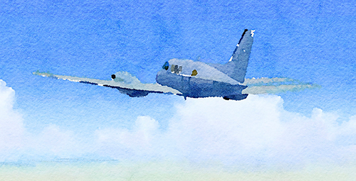
I am flying alone in a Beechcraft B80 Queen Air. The airplane, a twin-engine corporate and light transport aircraft, is owned by Lockheed Aircraft Corporation, my employer. It requires only a single pilot and can be configured for carrying up to 11 passengers or cargo. Max speed is 208 kts and normal cruise is about 180 – 190 kts. Max payload is 3,000 lbs., and GTOW is a little over 8,000 lbs.

The B80 is powered by two Lycoming IGSO-540-A1D piston engines rated at 380 hp each. The wingspan is 50 feet, 3 inches, and its length is 35 feet, 6 inches. I found it to have good flight characteristics and a pleasure to fly.

In 1972, Lockheed was bidding on the U.S. Army’s Cobra helicopter follow-on program with the AH-56A Cheyenne Advanced Attack compound helicopter. The Cheyenne had a four-blade main rotor, a four-blade tail rotor, an aft mounted three-blade pusher propeller, and low mounted aerodynamic wings, with hard points for launching anti-tank missiles and rockets. Powered by a single 4,275 shp GE-T64-716 turbo shaft engine, it flew at over 200 kts in some operational tests. Designed with a two-seat tandem cockpit, a gunner sat in the forward seat, which rotated 100 degrees to either side of centerline. This flexibility enabled the gunner to locate a target and remain locked-on to it regardless of the pilot’s flight maneuvers. The pilot occupied an elevated rear seat that offered excellent visibility to the front and sides. The prototype helicopter handled well and was fun to fly.

Lockheed’s program was operating from a test area called the Castle Dome Development site at the Army’s huge Yuma Proving Grounds in Arizona. We had a good facility about 40 miles west of Yuma, with a single, non-lighted runway.

A number of Lockheed employees decided to move temporarily to Yuma for the duration of the program. Others stayed in motels in Yuma during the week, opting to be shuttled from Burbank on Monday mornings and back to Burbank on Friday afternoons. These charter flights operated out of Laguna Army Airfield (KLGF), not far from Castle Dome. My wife and I decided to keep our family in the Los Angeles area, and so I became one of the weekly commuters.

Because of my status as a test pilot on the project, I was offered an occasional respite from being a passenger on the weekly commuter flights. Lockheed had its own “personal transport” available for the project, the Beechcraft I am flying. Often, to maintain schedules, ferry personnel, or quickly confirm test results, I was asked, as needed, to fly parts, passengers, or test data to and from Yuma. I would usually depart Laguna on short notice and fly direct to Van Nuys (KVNY), which was located close to Lockheed’s facility. Earlier today, I was asked to make a “data run,” transporting test data containing many lines of specialized code. A Lockheed tech employee would meet me at the Van Nuys airport and then drive the data to Lockheed’s offices where people and computers “crunched the numbers” and interpreted the raw data. Reports generated from the data would then be loaded back on the Queen Air for the return flight to Yuma at the end of the same day and be available for review the next morning when the morning crew in Yuma came in for work.

As I rotated the Queen Air and started my climb out of Yuma this morning, I took a moment to admire the painted colors of the desert slipping by below me. The vast ranges of sand and sagebrush, with layered purple mesas rising in the distance were stark, but beautiful. The Queen Air entered the overcast at just about 1,000 feet above the ground. The balance of the trip from Yuma to Van Nuys was solid IFR, with no precipitation, but with some snow showers possible in later forecasts for the return flight. Upon landing in Van Nuys, I was informed the data would take several hours longer than the normal three-hour turnaround time to process, so the results would not be available for me to transport back to Yuma until that evening. I was actually pleased with the news, and I quickly grabbed a company car and headed home to spend a little time with my wife and three girls.

After dinner that night, with goodnight hugs and kisses all around, I headed back to the airport, as I was advised the data had been processed and the stacks of completed reports were being loaded onto the plane. That scenario was pretty much how most data runs went. The return flight to Yuma ordinarily averaged about an hour and a half. This night, in early December 1972, was going to prove to be different.

Winter weather conditions were moving into the area along my planned route. Snow was no longer forecast for my return to Yuma, but lower freezing levels and turbulence were. The Queen Air was equipped for winter operations, with wing de-icing boots, fuselage-mounted lights to confirm wing ice status, heated windshield de-ice, and prop de-ice.

My IFR flight plan, with a 2100 (local) departure, was to climb to and maintain 6,000, Van Nuys direct Ontario. Then, direct Julian, direct Coyote Wells, Victor 137 to El Centro, then direct Yuma/Laguna. Flying the leg to Ontario, I encountered no significant weather, but there was some occasional moderate turbulence. I turned all de-ice equipment and pitot heat on as soon as I was in the clouds, except prop de-ice. On the leg to Julian, I experienced more turbulence and windshield ice was starting to form in corners and on protruding surfaces. I called LA Center and reported the ice, requesting another route. Center suggested a turn to 325 degrees, back toward Ontario, adding that two airliners had just departed Ontario and were not picking up ice. I made the turn and remained at 6,000 feet.

I was not concerned – yet.

My thoughts momentarily traveled back to earlier days and how I found myself sitting in the left seat of the Queen Air. Knowing of my interest in aviation as a boy, my father arranged for my first airplane ride. He had a friend who was the chief pilot for a large manufacturing company. The company owned a de Havilland DH.104 Dove, a twin-engine, polished aluminum beauty, which was used to transport businessmen and customers. From that flight, I knew I wanted a career in aviation.

I attended the University of Wisconsin and graduated in 1956. I met my wife there. While in the business school, I was also in an ROTC program. Upon graduation, I joined the Navy (a childhood dream of mine). At Pensacola, I was introduced to military flying, first in a Beech T-34 Mentor, then a North American T-28C Trojan. After winning my gold wings, I was assigned to a squadron flying Douglas A-4 Skyhawk attack jets. I flew two tours in Skyhawks from carrier decks (the USS Ranger CVA-61 and the USS Enterprise CVA-65) off the coast of North Vietnam until, on one mission, in a rapid descent while suffering with a head cold, one of my eardrums burst. I could no longer fly jets, so I asked for helicopters. I piloted a Sikorsky SH-3A/D Sea King on an additional deployment in Vietnam.

After my active-duty service, I applied to the airlines and to some defense contractors. United Airlines and Lockheed offered me jobs. Both letters arrived in my mailbox the same day. My background was more a natural fit with Lockheed, as I was a “rotor head,” had acquired experience in the Navy as a “systems guy,” and had earned an MBA degree during one of my rotations to shore duty.

I did encounter some ice in jets in the Navy, be we often flew so high and fast that it was never really an issue. At 6,000 feet in the Queen Air, doing about 180 kts, picking up ice was a very real possibility. Ice continued to accrete on the windshield, even with the windshield de-ice on. Fuselage lights showed no wing ice yet. Solid IMC. Prop de-ice is now on. I was relatively confident of the Queen Air’s de-ice capabilities should things get worse.

I am hand-flying – no autopilot – and doing careful crosschecks. My eyes move across the panel, from pitch to bank to power instruments. From attitude to airspeed, then vertical speed, then attitude again. Next, heading, compass, and turn and bank – all okay. Manifold pressures and prop RPMs steady. Suddenly, severe turbulence angrily invades my solitude and destroys my orderly instrument scan. I had taken the precaution of making sure my seatbelt was secure, but the convulsive forces on the control surfaces catch me off guard. Coming rapidly and unpredictably – left, right, up, down – I could not guess from which direction the next impact would hit me or anticipate how I could counter it. The Queen Air was being thrown violently around the sky. The instrument dials blur and are difficult to read. The aircraft’s angle of attack increases and decreases wildly in just seconds. The yoke is trying to bang against its stops.

Forget about holding altitude or heading. I try to concentrate on keeping the wings level. I have both hands tightly gripping the yoke as it forcibly bucks and gyrates in front of my chest. Instead of me pushing on the rudder pedals, the pedals punch erratically against my feet. I am fighting for control. I do not know if I am in command, or the turbulence is. I think about reducing airspeed to Va so the airplane will somehow continue to hold together in this fearsome pounding.

I glance hastily out my side window. Through the dark gray mist streaming by the fuselage lights, I see it. Ice. Ice everywhere! I was distracted by the turbulence. The rocking and rolling, so hellacious a moment ago, has abated somewhat. The airplane is semi-controllable, giving me a chance to concentrate. I check to make sure all de-ice equipment is on. It is. I cycle the wing de-ice boots. Nothing happens. I do not touch the throttles. The airspeed indicator confirms that the weight and aerodynamic drag of the accumulated ice is already slowing me down. The windshield is frozen over. I struggle to believe what I am seeing. The de-ice systems are failing me.

I sometimes wondered about a moment like this in a lifetime of flying. Will I think of my family? I could not bear to lose them. Will I panic or will I remain in control of my emotions? I have managed fears in the past. Sitting here now, I can feel my body’s natural response. Adrenaline is coursing through me; blood pressure up; face flushed; heart racing. Short, quick breaths. But I can still think clearly. I make up my mind. Taking some intentionally slow, deep breaths, I banish the desperate and unwelcomed thoughts as quickly as they come. I will fly the airplane. I can get out of this.

Suddenly, a sharp, metallic banging on either side of the B80’s nose in front of me. What is that? It sounds a little like the sound a seatbelt buckle makes if inadvertently locked outside the door of a small plane, the buckle free to strike crazily against the door in the slipstream. After a moment, I know. It is the prop de-ice slinging chunks of ice off the blades and against the thin aluminum skin of the airplane. The staccato sound is not rhythmic; it is loud, seemingly random, and a little asymmetric, with the left side taking more of a beating than the right side. It starts, stops, and then starts again.

The altimeter is slowly, steadily, unwinding. I am sinking out of my current altitude. Airspeed degrading. 130 kts now. Book stall speed is 80. I push throttles full forward to takeoff power, mixtures to full rich, and props full forward. The fuselage lights are now frozen over so I can no longer see the amount of ice building on the wing leading edges and across the upper surfaces. My feet dance on the rudder pedals, trying to keep the ball centered. Wrestling with the yoke to maintain wings level. Even with full power, I am still descending. Am I going to ride this airplane into the ground?

Jagged bolts of lightning now tear the black fabric of the night and light up the amorphous clouds engulfing me. Thunder crashes and reverberates in my ears. Turbulence continues to bat me around relentlessly. Never before have I so much wished to be somewhere – anywhere – else. I continue to battle the controls, but now I think I am losing.

I need to turn a few degrees to the left to try to get back on course, but the airplane seems to have a mind of its own. It wants to drift right instead. Sluggish and heavy on the controls. It feels as if I am flying sideways. Airspeed now 110 kts. With the load of ice, I am carrying, at what speed does the airplane stop flying? I remain alert for the stall warning horn. At any moment, the alarm could go on – and stay on. I wipe perspiration from my forehead with my shirtsleeve. My mind reels. What happens if the Queen Air stalls and falls out of the sky? At my current rate of descent, I will not have much time or altitude above the terrain to attempt a recovery.

A few moments later, I hear a short, loud boom. The aircraft is shaking noticeably. I think, “This is it!” Almost fearing to look, I turn my head to the side windows. The ice, inches thick in places, is slipping off the wings and engine nacelles in large sheets and in little pieces, disappearing into the black void behind me. Chunks of windshield ice are melting away. Then, it is almost all gone. Having descended below the overcast, the air is now clear and smooth. Airspeed and rate of climb increasing. The altimeter reads less than 3,000 feet. I am in control of the airplane again.

The lights of the city of Banning are visible to my left, Palm Springs to my right. I have not called a Mayday because I was too busy dealing with the emergency. I radio LA Center and, in as calm and as steady a voice as I can manage, I cancel my IFR flight plan and provide a PIREP on my just concluded ride in the turbulence and ice. I advise them my intention is now to proceed VFR direct Laguna.

Visibility under the overcast is excellent. I can see the Salton Sea, with hundreds of lights from residential neighborhoods, observable in the distance. In a few more minutes, El Centro and Yuma appear over the nose of the B80.

I make straight in for Runway 06, and land at KLGF. Seeing the runway lights on short final growing larger in the windshield in front of me is a welcomed sight. Earlier, during the worst of it, I was not certain I would ever land this airplane under control again. Boxes of processed data reports, securely tied down in the cabin behind me, are turned over to a waiting Lockheed employee. The employee makes no comment to me, although I must look ashen from my bout with the elements. The Queen Air, glistening in the hangar’s light and still dripping in places from the melted ice, is put away for the night, but not before I perform a walkaround. I notice a significant number of small, irregular-shaped dents on the left side of the fuselage, just about in line with the arc of the prop blades. Physical confirmation of my ordeal. I will tell them about the damage in the morning.

Now more relaxed, but physically spent, blood pressure and heart rate close to normal again, I am introspective on my drive to the motel. Two big questions: “Why did the de-ice equipment on the Queen Air, about as sophisticated and effective as any available, not perform better on this stormy night?” and “Why did I survive to tell the story?” In response to the former question, I think the technical answer is that the ice I encountered simply overwhelmed the de-ice systems. The rate of accumulation of ice exceeded the ability to shed it. As to the latter question, I cannot provide an answer. I have thought about it often. I wish I could.

Given the known ice certification of the Queen Air and the forecast information I reviewed at the time of my departure from Van Nuys, the intended flight presented a reasonable and manageable level of risk. What I could not know was, on this gloomy and random night, a demon lurked in the clouds. A cold, merciless demon, whose unwelcomed embrace has wrecked airplanes and claimed the lives of countless pilots and passengers in the past, and who will do so again in the future. Tonight, the demon stalked me.

I enjoyed a wonderful Christmas with my family in 1972. I had much to be thankful for.

In the end, the Cheyenne Attack helicopter was not chosen for further development and production. The Army opted instead for the Hughes AH-64 Apache Attack helicopter. I still believe the Cheyenne performed as well or better, and was as capable, as the Apache. But, after all, I am a Lockheed guy.

EDITOR’S NOTE: Dean Zakos (Private Pilot ASEL, Instrument) of Madison, Wisconsin, is the author of “Laughing with the Wind, Practical Advice and Personal Stories from a General Aviation Pilot.” Mr. Zakos has also written numerous short stories and flying articles for Midwest Flyer Magazine and other aviation publications.

DISCLAIMER: This article involves creative writing, and therefore the information presented may contain fictional information, and should not be used for flight, or misconstrued as instructional material. Readers are urged to consult with their flight instructor about anything discussed herein.

Posted in All Features, Features, Features, February/March 2023, Flying & Flight Experiences | Tagged , , , , , , , , , , , , , , , , , , , | Leave a comment

How To Become A Better Pilot

by Richard Morey
© Copyright 2022. All rights reserved!
Published in Midwest Flyer Magazine December 2022/January 2023 Digital Issue

In theory, we all want to be better, safer pilots. In practice, most of us are complacent with our skill level. We would like to be better but do not have a plan as to how to accomplish this. Most of us do not fly enough to maintain proficiency, let alone improve our skills. Three takeoffs and landings every 90 days will not do it. Neither will six (6) approaches in six (6) months. Being current is not the same as being competent and proficient.

The first step to becoming a better pilot is accepting that flying is a perishable skill. You quickly lose your edge with disuse. The second is committing yourself to improvement. How do we balance work, family, and our checking account, while continuing to improve our flying skills? The FAA, EAA, AOPA, NAFI and numerous other aviation organizations realize the truth to this, and the danger. I suggest that pilots take advantage of the multitude of free classes, seminars, and activities these organizations offer that are designed to help pilots improve their skill sets.

FAAsafety.gov

If you are not already signed up on FAAsafety.gov, you should be. This website lists FREE online classes, webinars, and safety seminars. One very useful feature is “preferences.” You can select what is of interest to you and receive email notifications of webinars and safety seminars. Registration is simple and straightforward. Do yourself a favor and spend some time on the site exploring options. The FAA now allows three (3) credits of classes to take the place of the oral portion of a flight review. Check with your flight instructor regarding how he feels about the program. I am suggesting all my flight review applicants take at least three (3) credits. Most have found it so useful, they take more!

Give Yourself A Mission!

Your local EAA Chapter offers a great opportunity to interact with other pilots. Often chapters will have fly-out activities. Fly-out breakfasts are more fun when you are sharing the ride and flying out with a group. Having a mission, rather than simply flying patterns for currency, gives us an enjoyable reason to plan a short cross-country flight, get exposed to a new airport, and share comradery.

VMC & IMC Clubs

Don’t like pancakes? EAA chapters also sponsor both VMC (Visual Meteorological Conditions) and IMC (Instrument Meteorological Conditions) clubs. Depending on your level of training, either or both could be valuable to your development as a pilot. These clubs are scenario-based and promote discussion and decision-making using real-world examples. Volunteer flight and ground instructors present the scenarios and moderate the discussions that follow. The interactive format allows pilots to hear the decision-making process among their peers, as well as examine their own reaction to the scenario. Because the actual outcome isn’t a part of the scenario, it allows for the examination of different decisions the pilot could have made along the way, based upon the information available. EAA has spent a great deal of time and resources to produce these programs. I find them very useful.

Study Groups

There are study groups available, or pilots can survey their local flying community to see if there’s interest in forming one. Some flight schools help coordinate study groups for students working on similar ratings, such as a prospective group of certified flight instructors (CFIs). EAA chapters may have ground school/mentor options for Ray Scholars and other new pilot prospects. The Wisconsin Chapter of the Ninety Nines offers an online study program twice monthly that is open to all prospective women pilots. Whether it’s through a chapter of an organization, a flight school, or just a few, like-minded pilots getting together, studying with a group can help hold you accountable and promote constructive discussion. It also helps with retaining information. Think about it…how many times have you been studying alone and been distracted, forgetting what you just read? Having to discuss and explain something helps you discover whether you really understand it. Working with others also allows you to learn new tips and share experiences. Bonus…. more hangar flying with new and old pilot friends.

Set Goals

Having a goal in mind is a great motivator. The following are a couple of good options.

WINGS Pilot Proficiency Awards Program

The FAA’s WINGS program is an excellent way to maintain and build skills. According to Advisory Circular 61-91H, “all pilots holding a recreational or higher pilot certificate may participate…in this 20-phase proficiency program.” Badges are awarded upon the completion of the first 10 phases, with certificates for the second 10. In airplanes, three (3) hours of flight training must be accomplished to include one (1) hour of basic aircraft maneuvers directed towards mastery of the airplane, one (1) hour of landings to include short field, soft field, and crosswind, and one (1) hour of instrument training in either an aircraft or simulator. The applicant must attend one (1) aviation safety program as well. Completion of a WINGS phase in an aircraft may substitute for a flight review. The WINGS program is ideal for those pilots who do best if there is a specific goal to work towards.

Fly Wisconsin Passport Program

Perhaps your mission is to visit as many airports in Wisconsin as possible and win prizes? The “Fly Wisconsin! Passport Program,” sponsored by the Wisconsin Airport Management Association (WAMA) and the Wisconsin DOT Bureau of Aeronautics, is open to all pilots and their passengers. Each participating airport has a stamp. Stamp your passport in the appropriate spot and collect as many as you wish. If you are looking for a reason to fly, this program gives you that, and is a great way to see Wisconsin and practice cross-country skills. Register online at https://2.selectsurvey.net/wisdot/TakeSurvey.aspx?SurveyID=FlyWI#. For additional information, go to http://wisconsindot.gov/Pages/travel/air/pilot-info/flywi-howto.aspx, email flywi@dot.wi.gov or call 608-266-3351. Not in Wisconsin? Check to see if your state has a similar program. I know Minnesota does as well.

Challenge Yourself In Your Flying

We all would rather do what we are good at and familiar with. This is natural but does not lend itself to improvement as a pilot. Instead of doing the same old thing, consider making your next flight a bit more challenging. A simple way to do this is to fly practice power-off landings. Reduce power to idle, opposite the point of intended touchdown and see how it goes. It is not unusual to have to add power for being too low or go around for being too high. Keep working at it until you can make the runway regularly without adding power. This is a great way to get a feel for just how far you can glide your aircraft. Once you feel comfortable with power-off approaches, find something else that you want to work on. If you feel uncomfortable doing so solo, take some instruction. Believe me, your flight instructor would much rather fly with you regularly, than once every two years.

Read Your Manuals

Pilots should be familiar with all the aircraft they fly, and all the equipment in those aircraft. If you have not recently reviewed the pilot’s operating handbook for the aircraft you fly, you should. Focus on normal and emergency procedures. If you fly a GPS-equipped aircraft, spend time going over the user’s guide. The user’s guide, manuals, and downloadable simulators are generally available at the manufacturer’s website. I can honestly say that most pilots I have flown with could use additional training in GPS operations. Doing so expands what is available to you as far as tools, so why not take advantage of it?

Read Aviation Magazines

You probably subscribe to several aviation magazines. If you are reading this, you definitely subscribe to Midwest Flyer Magazine. The staff of these magazines not only want to report on what is happening in aviation, but want you to be safe, proficient pilots. Read the articles. You may not agree with all you read, but I guarantee you will find some new ideas to think about.

In Closing

Being a proficient pilot takes some work, but this work need not be a chore. Understand that piloting skills are perishable. Realize that staying legally current is not the same as being proficient. Taking advantage of the online seminars and in-person safety meetings helps keep you proficient. Finding a reason to fly, both on your own and with an instructor, will go a long way to maintaining your level of proficiency. Have a goal with your flying, be it pancakes, passports or WINGS. Read handbooks and manuals. Join a study group. Read aviation publications, especially this one, which besides the “Pilot Proficiency” column I write, there’s “Instrument Flight” by Mick Kaufman, and articles presented by AOPA and others. Take some dual instruction. Find a way to have fun with your flying, while continuing to learn and maintain proficiency. All of these steps will lead to enjoying your flying more and being a safer pilot as a result, hopefully for many years to come!

EDITOR’S NOTE: Richard Morey was born into an aviation family. He is the third generation to operate the family FBO and flight school, Morey Airplane Company at Middleton Municipal Airport – Morey Field (C29). Among Richard’s diverse roles include charter pilot, flight instructor, and airport manager. He holds an ATP, CFII, MEII, and is an Airframe and Powerplant Mechanic (A&P) with Inspection Authorization (IA). Richard has been an active flight instructor since 1991 with over 15,000 hours instructing, and almost 19,000 hours total time. Of his many roles, flight instruction is by far his favorite! Comments are welcomed via email at Rich@moreyairport.com or by telephone at 608-836-1711. (www.MoreyAirport.com).

DISCLAIMER: The information contained in this column is the expressed opinion of the author only, and readers are advised to seek the advice of their personal flight instructor and others, and refer to the Federal Aviation Regulations, FAA Aeronautical Information Manual, and instructional materials before attempting any procedures discussed herein.

Posted in Columns, Columns, Columns, February/March 2023, Pilot Proficiency | Tagged , , , , , , , , , , , , , , | Leave a comment

The Garmin Aera 660

by Michael J. “Mick” Kaufman
© Copyright 2022. All rights reserved!
Published in Midwest Flyer Magazine December 2022/January 2023 Digital Issue

In a previous series of articles entitled “The Pilot’s New Panel,” I covered my recent budget update to the panel on my Bonanza. One of my comments was on the Garmin Aera 660 that was part of the install and that it was the best piece of avionics for the money I have ever purchased with an off-the-shelf price in the $800.00 range. This article describes some of the features of the Garmin Aera 660 and why you should have one in your airplane.

We have all figured out by now how important weather information in the cockpit is to the pilot. With the first introduction of the “Anywhere Map” a decade or more ago, it became a necessity for pilots, and pilots would not leave the vicinity of an airport without it.

Be aware that cell phone coverage becomes almost useless when flying more than a few thousand feet above the ground. There may be an occasion in some areas where you may be able to use a cell phone at a higher attitude. This is because the antennas on the cell sites are optimized for a specific area and tilted downward, as they are not meant for air traffic. The Anywhere Map I mentioned as the first usable inflight weather system, required being connected to a satellite phone with a subscription. So, there was a cost every time you checked weather in flight, but it was worth it on long cross-country flights. I still have my satellite phone and activated it recently for a short period of time for a flight into the Canadian wilderness as part of the annual fishing trip and pilgrimage to “Miminiska Lodge” (CPS5), hosted by Midwest Flyer Magazine in which we caught lots of fish!

A breakthrough in inflight weather came with the introduction of the Garmin 396 using a subscription to Sirius XM for weather, and this was fantastic! I still use that subscription service with the Garmin Aera 660. We are now several years into Automatic Dependent Surveillance-Broadcast (ADS-B), and with the government’s push to get aircraft owners to spend the money on devices, so the FAA can spy on us.

The FAA first offered free weather in the cockpit as part of ADS-B. Meanwhile, some ingenious technician designed ADS-B weather in a box that could be built on a $35.00 minicomputer called the “Raspberry Pi.” With the invent of inexpensive devices to provide free ADS-B weather, the incentive for pilots to spend thousands of dollars for ADS-B diminished, so the FAA offered cash rebates to aircraft owners who equipped their airplanes with ADS-B during a specified period of time. As of today, only 44% of all U.S. aircraft are ADS-B out equipped, and ground-based ADS-B weather does not compare to the superior satellite-based Sirius XM weather.

At the time of my panel upgrade, I needed to find a way to get weather in the cockpit and displayed on my iPad using ForeFlight. There were several devices on the market at the time, so I elected to try a device sold by Sporty’s Pilot Shop. It worked for a while, then quit working. I returned it to Sporty’s and got a replacement unit, which worked for a few days before it also died.

A new product surfaced from Garmin called the “GDL-52.” It was a bit pricier than the previous boxes, but I was able to work with Sporty’s (a great company, BTW) to get one. The GDL-52 arrived and worked flawlessly with ForeFlight to provide Sirius XM satellite weather, ADS-B traffic in, AHRS (attitude heading reference system), and ADS-B weather, all in one box. Garmin makes several flavors of the GDL-52, and I chose the portable version, which I now regret not removing from my Bonanza and using it in the Cessna 182 Skylane we flew to Canada, because we encountered some weather. Garmin also has a non-portable, certified version designated the “GDL-52R.” I had originally made plans to have my old Garmin 396 reinstalled, as my budgeted avionics install was already in progress. In a conversation with my good friend and BPT (Bonanza/Baron Pilot Training) colleague, Randy Bailey, he suggested adding a Garmin Aera 660 to the panel to replace the Garmin 396, and as luck would have it, there was an Air Gizmos box the same size as the box holding the 396 in the panel. My installer was a little reluctant to make the change but agreed to do so. The Garmin 396 was not retired, but rather installed in my seaplane.

To describe the Aera 660, it is awesome! The display is bright and crisp and puts the iPad to shame for readability in bright sunlight. After flying with the 660 for over two years, it does not overheat and shut down as the display does on my iPad, which has happened numerous times when I needed it the most.

The Aera 660 is hardwired to the Garmin GDL-52 and my Garmin 480 and allows the transfer of data between these boxes. I can send a flight plan data back and forth except for the direct-to command going to the Garmin 480 from the 660, which is blocked by software, probably for some liability issue, which is noted in the 660 manual. Using a Bluetooth connection with ForeFlight, I can also exchange flight plan data with the 660. My installer installed a toggle switch for me to select between which devices the data is exchanged.

For example, data is sent from the Garmin 480 to the 660, the switch is toggled, and the data is then sent to ForeFlight on the iPad, or the process is reversed. This provides some of the same functions as Garmin’s Flight Stream device with more features and less cost. The Aera 660 resembles a Garmin 650 without the com transmitter, and by using some of Garmin’s Nav/Coms, the 660 can tune the transceiver from its database. The database on the 660 is updated from a Garmin subscription every 28 days and the price is very reasonable. The database includes VFR/IFR enroute charts, as well as the IFR approach charts and a base map. The update is done whenever the unit is connected to WiFi. There’s no need for a computer or cable. I snap the unit out of its Air Gizmos adapter, take it home and turn it on and select “update.”

The touch screen face of the Aera 660 is very similar to that of the Garmin 650 with touch screen icons. Beginning in the upper left corner of the display is the base map displaying cities, navaids, airports, and other items that are user selectable.

To the right of the base map is a charts icon allowing the user to select VFR sectional charts, high and low altitude enroute charts and others. Next is a 3-D display that gives an Attitude and Heading Reference System (AHRS) display with three (3) selectable configurations using the six-pack instruments, altitude, speed tapes and a configurable Horizontal Situation Indicator (HSI). There is no AHRS in the 660 as it receives the AHRS data from the Garmin GDL-52, as well as GPS position data. The 660 does have its own GPS receiver, but I chose the one on the GDL-52 as it has an external antenna connected.

The Aera 760 with the bigger display has its own AHRS internally. The following icon to the right is the nearest icon allowing the pilot to find the nearest airports, flight service stations, navaids, ATC center frequencies and others. The second row of icons features waypoints and will display data received from a Garmin navigator – in my airplane, it is the Garmin 480 or ForeFlight on the iPad. If an approach is loaded on the connected 480 navigator, the approach chart for that approach is automatically loaded and displayed on the Aera 660. The next two icons show saved and active flight plans with the ability to save 50 flight plans for future use. The traffic icon will display ADS-B traffic and allows the user to select different ranges, as well as information about displayed traffic by touching the icon. A voice will provide traffic calls to alert the pilot of converging aircraft and terrain alerts, as well as a 500-foot altitude call out on an approach or while landing. Other icons on the main page will show terrain and weather.

On one of the setup pages, the pilot user may select the source for providing weather data with the options being Sirius XM, ADS-B or internet weather. The different weather products available depend on the source providing the weather. Weather features contain radar products, METARs, TAFs, winds aloft, cloud tops and much more. The option set up in my airplane allows me to select different information on any screen I choose. For example, traffic on my Garmin 480, weather radar on my Aera 660, and an approach chart with moving map on my iPad using ForeFlight. The options and information available using the Aera 660 seem endless and using it with the Garmin GDL-52 adds even more, such as Sirius XM music and entertainment.

Please remember as a pilot, we need to fly the airplane and too much information can cause problems. Pick your favorite screen and don’t change anything once on the final approach segment. All eyes on the Primary Flight Display (PFD) when on that final approach segment, and don’t saturate that PFD screen if you have one with unnecessary information. An HSI and a six-pack of gauges is all you need, but a flight director is also a great device to have. Memorize only the information critical to the approach like the Missed Approach Point (MAP) and the initial part of the missed approach segment. On a non-precision approach, the Minimum Descent Altitude (MDA) is also an important memory item. Enjoy the Garmin Aera 660, as I think it is the best avionics dollar you can spend!

EDITOR’S NOTE: Michael J. “Mick” Kaufman is a Certified Instrument Flight Instructor (CFII) and the program manager of flight operations with the “Bonanza/Baron Pilot Training” organization. He conducts pilot clinics and specialized instruction throughout the U.S. in many makes and models of aircraft, which are equipped with a variety of avionics. Mick is based in Richland Center (93C) and Eagle River, Wisconsin (KEGV). He was named “FAA’s Safety Team Representative of the Year” for Wisconsin in 2008. Readers are encouraged to email questions to captmick@me.com, or call 817-988-0174.

DISCLAIMER: The information contained in this column is the expressed opinion of the author only, and readers are advised to seek the advice of their personal flight instructor and others, and refer to the Federal Aviation Regulations, FAA Aeronautical Information Manual, and instructional materials before attempting any procedures discussed herein.

Posted in Columns, Columns, Columns, February/March 2023, Instrument Flight, Uncategorized | Tagged , , , , , , , , , , , , , , , | Leave a comment

Hangar Has Look of Texas Flare!

Published in Midwest Flyer Magazine December 2022/January 2023 Digital Issue

FAIRFAX, MINN. – Fredericksburg, Texas, in the Hill Country west of Austin and north of San Antonio, might be the next best thing to crossing the Atlantic. The region is lush, colorful and, unlike much of the pancake-flat state, dotted with beautiful green hills that are evocative of Tuscany or the south of France. Towns like Fredericksburg offer a taste of the Old World, with German-style biergartens, schnitzelhauser and a lot of wineries.

That may have been the exact thoughts of Bill Lucy, who recently chose to move to Fredericksburg from Horseshoe Bay, Texas, to build his new home after he built a hangar and an adjacent 1600-foot grass airstrip.

Lucy said he made his decision to purchase a Schweiss bifold liftstrap door after reading a story on the Schweiss Doors website, about old-timer pilot Gene Fuchs of Morgan, Minn., who owns three Schweiss doors.

Once the door arrived, Lucy found the ‘yellow book’ (instruction manual), and erecting the door went exceptionally well. In fact, it became a frequent phrase when he had a question: ‘It’s in the book!’”

The bifold liftstrap door on Lucy’s hangar measures 40 feet by 14 feet clear, more than adequate to hangar his WWII-vintage Boeing Stearman Model 75 biplane. The bifold door opens and closes quickly and quietly with four strong liftstraps and locks weathertight with the patented auto latch strap system that Schweiss bifold doors are known for.

Lucy’s love of flying, which began 43 years ago at Horseshoe Bay, has led him to a career flying mid-size cabin, eight-passenger Citation Sovereign jets for NetJets.

“A college friend gave me his collection of flying magazines and I read every one, cover to cover,” Lucy says. “Many of my dates with soon-to-be-wife, Cheron, included watching planes land at KHOU (William P. Hobby Airport). After college, we had the privilege to start flying lessons together. Cheron and I both received our private licenses in 1971. All of our flying was for business and pleasure until I started with NetJets in 2001.”

Lucy’s new 85 by 40 ft steel red and white hangar stands out like the colorful wildflowers that emblazon the hills around Fredericksburg. Their adjacent ranch home was designed and built by his son, Travis, who is an architect with Bercy Chen Architects of Austin, Texas. The home is contemporary and complements the ranch setting.

“The design for the hangar started with our desire for it to include a bunkhouse for grandkids, office and workshop,” Lucy says. “Cheron picked the color, the red barn-look for our ranch.”

Lucy’s 1,600-ft grass airstrip breaks at about 800 feet and slopes downhill, he says. “It is fenced to keep the Red Angus cows we raise off the runway when we are flying. When my landings go past 800 feet, they are really going downhill fast. I can leap tall buildings in a single landing.”

Schweiss Doors is the premier manufacturer of hydraulic and bifold liftstrap doors (www.bifold.com).

Posted in Airports, February/March 2023, Products & Services, Sections, Sections | Tagged , , , , , , , , | Leave a comment

AOPA Launches Alliance Program To Cross-Promote Complementary Aviation Organizations

Published in Midwest Flyer Magazine October/November 2022 Digital Issue

The Aircraft Owners & Pilots Association (AOPA) is introducing the AOPA Alliance program with the Antique Airplane Association (AAA). Niche aviation associations and type clubs, such as AAA, are a critical part of the GA fabric. While they are among the most avid aviation groups, AAA (and other such groups) may be unknown to many pilots and aircraft owners who would benefit from their educational programs and sense of community.

The AOPA Alliance program will support these organizations through a dedicated webpage on aopa.org and exposure in AOPA print, online, and video media channels. AOPA allied organizations will, in turn, educate their members about AOPA’s mission and initiatives through their websites, channels, and events.

Based at Antique Airfield in Blakesburg, Iowa, AAA is the world’s oldest organization dedicated to antique and classic aviation. Formed in 1953 by Robert L. Taylor, and currently run by his son, Brent Taylor, its mission is to help the owners, restorers, and pilots of antique and classic aircraft to “keep the antiques flying.” The association comprises 3,500 members across the United States, who fly a range of vintage and classic aircraft dating from the 1920s through the 1950s.

Each Labor Day weekend, members gather at the annual AAA/APM Invitational Fly-in held at Antique Airfield.

“While different organizations may have different goals and memberships, all of GA needs to come together and protect our shared passion for aviation and our collective freedom to fly,” said AOPA President Mark Baker. “Members of the Antique Airplane Association are among the most passionate aviators we know and share many values with AOPA. This is a great fit, and we look forward to such partnerships with other organizations.”

“When AOPA began in 1939, most of the airplanes viewed today as antique or classic aircraft were then current production airplanes,” said Taylor. “This affiliation will bridge that past with the present for both organizations. This opportunity helps our respective organizations attract new members.”

To inquire about your organization becoming an AOPA allied organization, contact AOPA.

Posted in All Headlines, AOPA, Headlines, Headlines, Oct/Nov 2022 | Tagged , , , , , , , , , , | Leave a comment

New Faces at the Wisconsin Bureau of Aeronautics

Published in Midwest Flyer Magazine October/November 2022 Digital Issue

We’re happy to announce we have several new faces that have joined the Wisconsin Bureau of Aeronautics (BOA) in the last few months. As always, you can view our entire staff directory on our website at https://wisconsindot.gov/av‐pubs.

Kelly Halada – Assistant Aeronautical Environmental Coordinator

Kelly Halada joined the BOA as an Assistant Aeronautical Environmental Coordinator in June 2022. Kelly is responsible for ensuring compliance with state and federal environmental laws regarding Wisconsin state-funded airport projects.

Kelly’s duties include coordination with regulatory agencies, including the Wisconsin Department of Natural Resources (WDNR) and U.S. Army Corps of Engineers. She is also responsible for completing the associated environmental documentation required for Wisconsin airport projects that utilize state or federal funding. Kelly also serves as an internal resource to BOA staff. Kelly is part of the environmental team at the BOA, with goals to focus on the environmental compliance processes surrounding the construction of airport projects.

Kelly earned two Bachelor of Science degrees in Political Studies and Environmental Studies from the University of Wisconsin-Madison. Before joining BOA, she interned for the WDNR in the Aquatic Invasive Species Division. Kelly currently lives in Fitchburg, Wisconsin and loves snuggling her cats, hiking, and visiting Devil’s Lake with her husband.

For any questions concerning environmental issues at the Bureau of Aeronautics, please feel free to contact Kelly at kelly.halada@dot.wi.gov or (608) 267-3633.

Jesse Friend – DBE/Labor Compliance Specialist

Jesse Friend joined the BOA in July of 2022 as a Disadvantaged Business Enterprise (DBE)/Labor Compliance Specialist. Jesse joins Shannon Clary and Crystal Wilson in the DBE/LC office and will work closely with BOA project managers, consultants, and contractors to resolve labor compliance issues on airport construction projects.

His primary role is to ensure that airport construction projects meet contract requirements for prevailing wages, payments to subcontractors and nondiscriminatory practices. This includes auditing for Equal Employment Opportunities, Title VI, and Title VII compliance and assisting with management of the bureau’s DBE program.

Prior to joining the bureau, Jesse worked with the Department of Justice firearms unit, processing background checks for firearms purchases and Concealed Carry Weapon permits. In his free time, Jesse enjoys hassling his cats, having small adventures around the state, and playing overly complicated board games with his friends.

For questions regarding labor compliance, please contact Jesse at jessed.friend@dot.wi.gov or call (608) 264-9927.

New BOA Project Managers

Three of the new BOA staff members are project managers. In general, BOA project managers are responsible for helping airports develop a realistic and achievable capital improvement plan; contracting with consultants for planning, design, and construction engineering services; conducting plan reviews; and working as a liaison between local sponsors and state and federal agencies.

Tyler Leslie – Airport Engineering Specialist

Tyler Leslie joined the BOA in May 2022. Tyler earned a bachelor’s degree in Political Science with a minor in Legal Studies from the University of Wisconsin-La Crosse in 2018. Before joining the Bureau of Aeronautics, he worked in the Compliance Bureau at the Wisconsin Department of Revenue.

In his free time, Tyler enjoys reading, hiking, and listening to music. Tyler can be contacted at (608) 267-9396 or tylerd.leslie@dot.wi.gov.

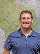
Colin Davidson – Airport Development Engineer

Colin Davidson joined the BOA in July 2022 as an Airport Development Engineer. Colin earned bachelor’s degrees in Mechanical Engineering and Business Administration from the University of Kansas in 2012 and is a registered Professional Engineer in the State of Kansas. He is currently pursuing a master’s degree in Business Administration from MSOE University in Milwaukee.

Colin comes to the BOA after having worked for the past 10 years at a consulting engineering, procurement, and construction firm located in Kansas City. There, he primarily worked on projects in the oil and gas industry.

Colin and his wife live in Wauwatosa and enjoy traveling, hiking, biking, and exploring their beautiful new home state of Wisconsin. He is excited to be able to combine his personal interest in aviation and travel with his career as an engineer.

Colin can be reached by phone at (608) 266-2542 or by email at colin.davidson@dot.wi.gov.

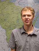
Samuel Lee – Airport Development Engineer

Samuel Lee joined the BOA in July 2022 as an Airport Development Engineer. Sam earned a Bachelor of Science degree from the University of Wisconsin-Milwaukee in Civil Engineering. Sam looks forward to helping airports across Wisconsin meet their future development goals. Sam has lived in both Madison and Milwaukee and enjoys outdoor activities like fishing and running.

You can contact Sam by phone at (608) 267-3584 or by email at samuel.lee@dot.wi.gov

Posted in Columns, Columns, Columns, Oct/Nov 2022, Wisconsin Aeronautics Report | Tagged , , , , , , , , | 5 Comments